


Find YOUR path

Chester Valley Trail
A Shared Use or Easy Multi-Use path about 30-35 minutes away
Note that Pennsylvania has prioritized connecting the Northwest Lancaster Rail Trail, Enola Low Grade Trail, the Chester Valley Trail, and the Schuylkill River Trail to create the Schuylkill to Susquehanna Greenway. While the the Chester Valley Trail and the Schuylkill River Trail were connected in 2023, work to close the remaining gaps will take many years.

A 1.8 mile section of Shared Use path each way, the closest to Kennett


A 1.7 mile section of Shared Use Path each way, the closest to Kennett.

An Easy 4 mile section of Multi-Use Path each way, the furthest from Kennett

An Easy 4.5 mile section of Multi-Use Path each way, the furthest from Kennett
-
Legend reveals the symbols indicating different sections.
-
Home re-centers the map on the trail.
-
Click here to open the map in a new window.

Home

Your location

Legend

A 3.4 mile Shared Use Path 30 minutes away
Main St Exton to Exton Park
Universal Access (UA): This path appears to meet all standards for Shared Use Paths
Effort: This 3.6 mile section (about 1.8 miles each way) has a Flat Equivalent Length of 3.7 miles and merits a Maximum Extra Effort Rating of Universal Access.
Stress: As a shared use path, this is generally rated as no stress for most users. There are 5 crossings - 3 with traffic signals on more heavily travelled roads (note that the Rt 100 crossing was recently simplified so only one signal is needed), and a connection added to the train station at Rt 30.
Other features: This is a busy, sunny path, with benches along the way. There is a restroom, playground, picnic tables, ample parking, and easy trail access at Exton Park. This is also the closest access for many Kennett residents.
Connections: Continue east to Battle of the Clouds Park to add 3.4 miles to your round trip.
Getting there: Click here (or on the map) for directions to the Exton Park trailhead (the closest to Kennett Square).
Trail maps: Click directly on the maps below to navigate, or click here open the map in a new window.
-
Click Home to re-center the map on the path.
-
Click Your Location to track your progress while you hike.
-
Click on Legend to see the symbols indicating different grades and cumulative grade ratings
-
Click on Layer to select specific layers (like 10' grade ratings, cumulative grade ratings, and so on) you want to turn off.
Home
Your location
Legend
Filter
Layer

Exton Park to Battle of the Clouds
A 3.6 mile Shared Use Path about 30 minutes away
Margot enjoying a walk with her classmate - March 2021
Universal Access (UA): This path appears to meet all standards for Shared Use Paths
Effort: This 3.3 mile section (1.7 miles each way) has a Flat Equivalent Length of 3.3 miles and merits a Maximum Extra Effort Rating of Universal Access.
Stress: As a shared use path, this is generally rated as no stress for most users. There are 3 crossings with crosswalks but no signals.
Other features: This is a busy, sunny path, with benches along the way. There is a restroom, playground, picnic tables, ample parking, and easy trail access at Exton Park (this is also the closest access for many Kennett residents). There is also ample parking and easy path access at Battle of the Clouds Park.
Connections: Continue east from Battle of the Clouds Park to Wegmans to add 6 miles to your round trip, or continue west from Exton Park to Main St Exton to add 3.6 miles to your round trip.
Getting there: Click here (or on the map) for directions to the Exton Park trailhead (the closest to Kennett Square).
Trail maps: Click directly on the maps below to navigate, or click here open the map in a new window.
-
Click Home to re-center the map on the path.
-
Click Your Location to track your progress while you hike.
-
Click on Legend to see the symbols indicating different grades and cumulative grade ratings
-
Click on Layer to select specific layers (like 10' grade ratings, cumulative grade ratings, and so on) you want to turn off.
Home
Your location
Legend
Filter
Layer
Battle of the Clouds to Wegmans
A 6 mile Shared Use Path 30 minutes away
Universal Access (UA): This path appears to meet all standards for Shared Use Paths
Effort: This 6 mile section (3 miles each way) has a Flat Equivalent Length of 6.2 miles and merits an Cumulative Grade Rating of Universal Access.
Stress: As a shared use path, this is generally rated as no stress for most users. There are 2 crosswalks without signals on quiet roads, and 2 signaled crossings on busy roads (the last just west of Wegmans is especially busy).
Other features: This is a busy path, with benches along the way. the western half is nicely shaded. There is a playground, picnic tables, ample parking, and access to the path from the Battle of the Clouds Park (the closest parking for many Kennett residents). There is also ample parking and easy access to the path from Wegmans (and of course food and bathrooms!).
Connections: Continue west to Exton Park to add 3.4 miles to your round trip, or continue west to D'Ambrosia Park to add 8 miles to your round trip.
Getting there: Click here (or on the map) for directions to the Battle of the Clouds Park trailhead (the closest to Kennett Square).
Trail maps: Click here to open the map in a new window.
To see the grade in each direction for each 10' section on the map to the left, click on Filter and select the direction (remember to toggle the filter on).
-
Click on Legend to see the symbols indicating different grades.
-
Click Home to re-center the map on the path.
-
Click Your Location to track your progress while you hike.
Home
Your location
Legend
Filter
Layer

A 8 mile Shared Use Path 30 minutes away
Wegmans to D'Ambrosia Park
Universal Access (UA): This path appears to meet all standards for Shared Use Paths
Effort: This 7.8 mile section (3.9 miles each way) has a Flat Equivalent Length of 8.4 miles and merits a Cumulative Grade Rating of Easy. Depending on the direction, the longest continuous grades are as follows: a 100-260' section with at least easy grades, an 80-110' section with at least easy to moderate grades, an 80-110' section with at least moderate grades, an 80-110' section with at least difficult grades, and a 10-20' section with more difficult grades.
Stress: As a shared use path, this is generally rated as no stress for most users. There are 3 crosswalks without signals, but on relatively quiet roads.
Other features: This is a busy path, with benches along the way. The western half is nicely shaded. There is also ample parking and easy access to the path from Wegmans (and of course food and bathrooms!). There is a playground, picnic tables, ample parking, and easy trail access from Battle of the Clouds Park (the closest parking for many Kennett residents).
Connections: Continue west to County Line Road to add 6 miles to your round trip, or continue east to Battle of the Clouds Park to add 8 miles to your round trip.
Getting there: Click here (or on the map) for directions to the Wegman's trailhead (the closest to Kennett Square).
Trail maps: Click here to open the map in a new window.
To see the grade in each direction for each 10' section on the map to the left, click on Filter and select the direction (remember to toggle the filter on).
-
Click on Legend to see the symbols indicating different grades.
-
Click Home to re-center the map on the path.
-
Click Your Location to track your progress while you hike.
Home
Your location
Legend
Filter
Layer
D'Ambrosia Park to County Line Rd
An Easy 6.3 mile Multi-Use Path 35 minutes away
Universal Access (UA): This path exceeds standards with respect to running grade for Shared Use Paths. It otherwise meets all standards for surface, obstacles, and cross-slope.
Effort: This 6.3 mile section (3.15 miles each way) has a Flat Equivalent Length of 6.7 miles and merits a Maximum Extra Effort Rating of Easy to Hard heading west, and Very Easy heading east. The route includes short sections of Easy Grades except for one 220' section of Easy uphill grades just east of the trailhead on County Line Road. .
Stress: As a multi-use path, this is generally rated as no stress for most users. There are 3 crosswalks without signals, but on relatively quiet roads.
Other features: This is a busy path, with benches along the way. The western half is nicely shaded. There is also ample parking and easy access to the path from Wegmans (and of course food and bathrooms!). There is a playground, picnic tables, ample parking, and easy access from Battle of the Clouds Park (the closest parking for many Kennett residents).
Connections: Continue west to the Schulkyll River Trail in Norristown to add 9 miles to your round trip, or continue east to Wegmans to add 8 miles to your round trip.
Getting there: Click here (or on the map) for directions to the D'Ambrosia Park trailhead (the closest to Kennett Square).
Trail maps: Click directly on the maps below to navigate, or click here open the map in a new window heading east, and click here for a map heading west.
-
Click Home to re-center the map on the path.
-
Click Your Location to track your progress while you hike.
-
Click on Legend to see the symbols indicating different grades and cumulative grade ratings
-
Click on Layer to select specific layers (like 10' grade ratings, cumulative grade ratings, and so on) you want to turn off.
Home
Your location
Legend
Filter
Layer
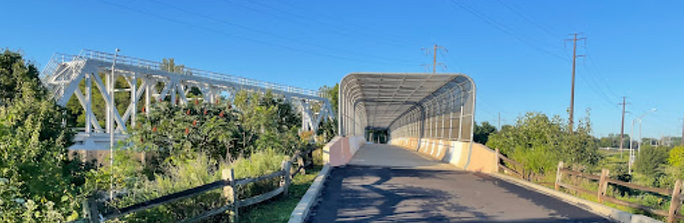
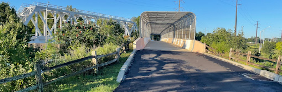
County Line Rd to Norristown
An Easy 9 mile Multi-Use Path 35 minutes away

Universal Access (UA): This path exceeds standards with respect to running grade for Shared Use Paths. It otherwise meets all standards for surface, obstacles, and cross-slope.
Effort: This 9 mile section (54.5 miles each way) has a Flat Equivalent Length of 9.9 miles and merits a Cumulative Grade Rating of Hard. Depending on the direction, the longest continuous grades are as follows: a 140-170' section with at least easy grades, an 80-100' section with at least easy to moderate grades, a 70-90' section with at least moderate grades, and a 70-90' section with at least difficult grades.
Stress: As a multi-use path, this is generally rated as no stress for most users. There are 3 crosswalks without signals, but on relatively quiet roads.
Other features: This is a busy path, with benches along the way. The western half is nicely shaded. There is also ample parking and easy trail access at Wegmans (and of course food and bathrooms!). There is a playground, picnic tables, ample parking, and easy trail access at Battle of the Clouds Park (the closest parking for many Kennett residents).
Connections: Continue east to D'Ambrosia Park to add 8 miles to your round trip.
Maps: Click here (or on the map above) for directions to the Chester Valley Trail parking just east of County Line Rd (the closest to Kennett Square).
Trail maps: Click directly on the maps below to navigate, or click here open the map in a new window heading east, and click here for a map heading west.
-
Click Home to re-center the map on the trail.
-
Click Your Location to track your progress while you hike.
-
Click on Legend to see the symbols indicating different grades and cumulative grade ratings
-
Click on Layer to select specific layers (like 10' grade ratings, cumulative grade ratings, and so on) you want to turn off.
Home
Your location
Legend
Filter
Layer